1960s Maps of Uinta County, Wyoming
Explore 53 historic maps of Uinta County from the 1960s. These maps offer a rare glimpse into what life looked like during the 1960s — showing old roads, neighborhoods, homes, and landmarks that have changed or disappeared over time.
Whether you're researching your family's past, planning a metal detecting trip, or studying how Uinta County's landscape evolved across the 1960s, these high-resolution maps are a powerful tool for exploring the history of this region.
- Focus on a specific era: All maps on this page are from the 1960s, giving you a focused view of this time period.
- See what’s changed: Compare century-old streets, trails, and buildings to today's modern landscape using overlays and satellite layers.
- Research with precision: Use these maps for genealogy, historical research, land use analysis, or educational projects.
- View, download, or print: Maps are fully viewable online in high resolution, and can be downloaded or printed for your own records.
Start exploring Uinta County's history through authentic maps from the 1960s. This is your window into the past.
Uinta County, WY maps
(53)- 1960 Map of Ogden
 1960 Ogden1960 Print · USGSIn the mid-1950s, this region of the American West balanced military expansion with frontier history along the Union Pacific RR. Genealogists and historians can trace old settlements like Fort Bridger, the residential growth of Washington Terrace, and industrial sites from the Hill AFB complex to the coal mines of Kemmerer.
 - 1960 Map of Salt Lake City
 1960 Salt Lake City1960 Print · USGSThe Wasatch Front and High Uintas are captured mid-century as the Salt Lake Valley underwent significant postwar expansion. Genealogists and historians can trace rail lines like the Union Pacific and locate established landmarks such as Fort Douglas, Camp Williams, and the Bingham Canyon Mine.
 - 1962 Map of Sawtooth Mountain, 1965 Print
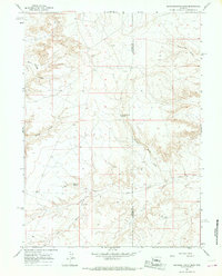
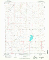
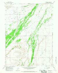
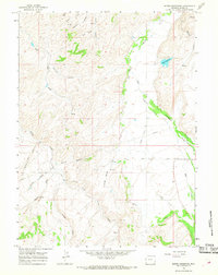
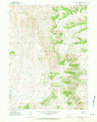 1962 Sawtooth Mountain1965 Print · USGSUinta County was a landscape of high divides and remote trails in the early sixties. Researchers can trace the rugged drainage of Cottonwood Creek and locate a specific Mine situated between The Hogback and South Sheep Mtn.3 unique versions available
 - 1962 Map of Cumberland Gap, 1965 Print
 1962 Cumberland Gap1965 Print · USGSHigh desert ranching and early rail history meet in the early sixties along the Lincoln and Uinta county line. Researchers can trace the Union Pacific Railroad Old North Fork Grade and locate family landmarks like Ziller Ranch or the Cumberland Cem.2 unique versions available
 - 1962 Map of Elkol SW, 1965 Print
 1962 Elkol SW1965 Print · USGSThe Lincoln and Uinta county borderlands are captured here in the early sixties, showing a landscape of high-basin drainage and mineral exploration. Genealogists and researchers can trace the rugged Jeep Trail routes through Cumberland Flats past isolated Mine and Prospect sites.3 unique versions available
 - 1962 Map of Bell Butte, 1965 Print
 1962 Bell Butte1965 Print · USGSThe high Wyoming ranchlands of Uinta and Lincoln counties are captured here in the early sixties. Genealogists and historians can locate the Hayward Place or trace the many branches of Sheep Creek and Carter Creek across this high-elevation landscape.
 - 1964 Map of Butcher Knife Draw, 1967 Print
 1964 Butcher Knife Draw1967 Print · USGSSweetwater County during the mid-sixties shows a transition from open range to an emerging energy landscape. Researchers can trace water sources like Shurtliff Spring and Butcher Knife Spring alongside early Gas Wells and Drill Holes.2 unique versions available
 - 1964 Map of Soap Holes Reservoir, 1968 Print
 1964 Soap Holes Reservoir1968 Print · USGSHigh desert ranchlands and water management projects define this corner of Sweetwater and Uinta counties in the 1960s. Researchers can trace remote livestock networks and early energy exploration through sites like Soap Holes Reservoir, Standard Pit, and the winding Cedar Mountain Road.2 unique versions available
 - 1964 Map of Reed Reservoir, 1968 Print
 1964 Reed Reservoir1968 Print · USGSHigh desert ranching and water management define this Wyoming landscape in the mid-1960s. Trace the network of upland water sources including Whisky Reservoir, Clematis Reservoir, and the paths along Cottonwood Bench.2 unique versions available
 - 1964 Map of Fort Bridger, 1968 Print
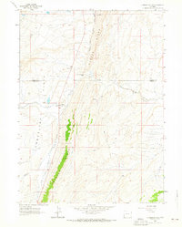
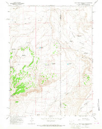
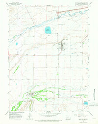
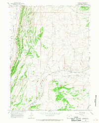
 1964 Fort Bridger1968 Print · USGSFort Bridger and the surrounding Uinta County high desert are captured here in the mid-sixties, showing the intersection of frontier history and modern utility. Researchers can trace the Emigrant Trail or locate family roots near Millburne Cem and the Fort Bridger historic grounds.4 unique versions available
 - 1964 Map of Carter, 1968 Print
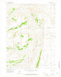
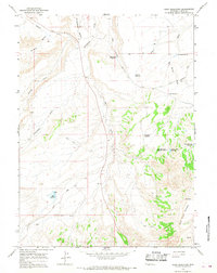
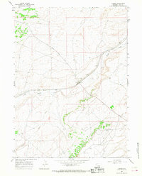 1964 Carter1968 Print · USGSUinta County's high plains landscape is captured in the mid-1960s, centered on the historic rail town of Carter. Genealogists and historians can trace the Union Pacific corridor, the Fort Bridger Airport, and the path of Big Muddy Creek.
 - 1964 Map of Mountain View, 1968 Print
 1964 Mountain View1968 Print · USGSThe Bridger Valley in the mid-sixties shows a landscape of steady growth and deep-rooted irrigation. Researchers can trace the legacy of the Fort Bridger Trail alongside modern developments like Rollins Reservoir and the Fairground at Lyman.2 unique versions available
 - 1964 Map of Lonetree, 1968 Print
 1964 Lonetree1968 Print · USGSLonetree and the surrounding ranchlands of Uinta County appear in the mid-1960s as a landscape defined by high-desert irrigation. Researchers can trace the heritage of local homesteads like Smith Ranch and locate the historic Lonetree Cem near Henrys Fork.2 unique versions available
 - 1964 Map of Table Mountain, 1968 Print
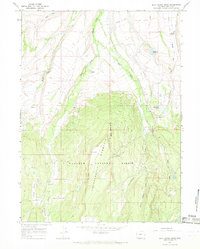
 1964 Table Mountain1968 Print · USGSHigh-altitude wilderness in Uinta County is captured here in the mid-1960s, showing the high plateaus bordering the Utah line. Researchers can trace remote transit routes like Jeep Trails and a Landing Strip alongside vital water sources like Whiskey Spring and Henrys Fork.2 unique versions available
 - 1964 Map of Wildcat Butte, 1968 Print
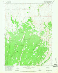
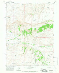
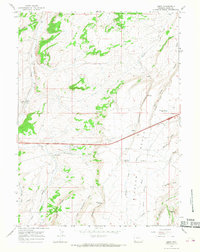
 1964 Wildcat Butte1968 Print · USGSThe high plains of Uinta County were undergoing a mid-century industrial transformation when this survey was field-checked. Researchers can trace the energy infrastructure of the era through the Refinery, Church Butte Camp, and family-named landmarks like Blumel Draw.
 - 1964 Map of Austin Reservoir, 1968 Print
 1964 Austin Reservoir1968 Print · USGSThe high desert of Uinta County is captured here in the mid-1960s, showing a landscape defined by the Union Pacific rail line and water engineering. Trace the paths of the Austin Canal and pipelines near landmarks like the Pinnacle.2 unique versions available
 - 1964 Map of Burntfork, 1968 Print
 1964 Burntfork1968 Print · USGSThe ranching country of Uinta County is captured here in the mid-1960s, showing the intricate water systems that sustained this high-desert community. Researchers can trace family history through the Stewart Cem and locate local landmarks like Turtle Bluff and the Nielsen Ditch.2 unique versions available
 - 1964 Map of Leavitt Bench, 1968 Print
 1964 Leavitt Bench1968 Print · USGSUinta County ranching and water management are captured here in the mid-1960s as high-plateau agriculture took shape. Local historians can trace family operations like the Slagowski Ranch and vital irrigation works including the Kidman Wall Canal.2 unique versions available
 - 1964 Map of Buck Fever Ridge, 1968 Print
 1964 Buck Fever Ridge1968 Print · USGSUinta County ranching and water management are captured here in the mid-1960s, showing a landscape of high ridges and engineered irrigation. Trace old sheep and cattle routes through Lambs Meadow, the Perry Ranch grounds, and along the Botero Ditch.2 unique versions available
 - 1964 Map of Robertson, 1968 Print
 1964 Robertson1968 Print · USGSThe settlement of Robertson and the site of Fort Supply are captured here in the mid-sixties, showing the intersection of pioneer history and high-desert ranching. Trace early water rights through the Pine Grove Canal and find the Johnson Cem near Willow Creek.2 unique versions available
 - 1965 Map of Evanston, 1968 Print
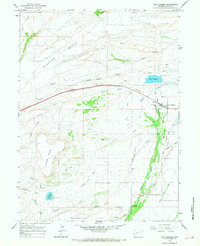
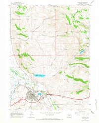 1965 Evanston1968 Print · USGSEvanston and the Bear River valley are captured in the mid-sixties as a thriving rail and ranching hub. Trace the Union Pacific Railroad past local landmarks like the State Hosp, Crompton Reservoir, and the Cemetery.3 unique versions available
 - 1965 Map of Bridger, 1968 Print
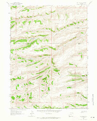
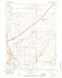
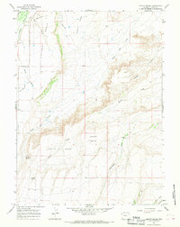
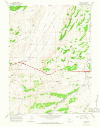
 1965 Bridger1968 Print · USGSUinta County in the mid-1960s shows a landscape shaped by the Union Pacific railroad and the rugged Hogsback ridge. Researchers can trace the rail corridor through Bridger and Antelope or locate old travel routes like the Carter Cutoff Road.2 unique versions available
 - 1965 Map of Ragan, 1968 Print
 1965 Ragan1968 Print · USGSUinta County's high plains in the mid-1960s reveal a landscape shaped by both early migration and modern energy extraction. Researchers can trace the Emigrant Trail as it parallels the Union Pacific near the Spring Valley Cem.3 unique versions available
 - 1965 Map of Myers Reservoir, 1968 Print
 1965 Myers Reservoir1968 Print · USGSThe high country of Uinta County in the mid-sixties is defined here by its riparian corridors and ranching infrastructure. You can trace early regional transit along Chalk Creek Road and locate family landmarks like Randal Springs and Bessie Bottom.2 unique versions available
 - 1965 Map of Leroy, 1968 Print
 1965 Leroy1968 Print · USGSUinta County's high-plateau landscape is captured here in the mid-1960s, showing the intersection of vital transport and water routes. Researchers can trace the path of the Emigrant Trail or locate the railroad stop at Leroy and its namesake Musselman Springs.2 unique versions available
Showing maps 1-25 of 53
Top cities of Uinta County
- Evanston historical maps
- Lyman historical maps
- Mountain View historical maps
- Bear River historical maps
Frequently asked questions
- What are the different types of historical maps available for Uinta County?
- What is the oldest map of Uinta County?
- Where can I purchase historical maps of Uinta County for my home or office?
- Where can I download high-res historical maps of Uinta County?
- Are there historical topographic maps available for Uinta County?
- Is there historical aerial imagery available for Uinta County?
- Where are historical maps of Uinta County sourced from?