
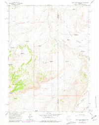
1964 Map of Soap Holes Reservoir
USGS Topo · Published 1968About this map
High desert ranching and water management define the landscape on the border of Uinta and Sweetwater counties in the mid-1960s. The topography is dominated by large tablelands like Cedar Mountain and Cedar Rim Mountain, which rise above a network of seasonal drainages including Dry Creek and Big Hollow Creek. The reliance on surface water for livestock or industrial use is evident in the numerous small impoundments scattered across the terrain, from the namesake Soap Holes Reservoir to the Hordeum Reservoir in the north. This network of reservoirs, often connected by a Jeep Trail or the Cedar Mountain Road, reflects a high-altitude arid environment where water is the primary driver of human activity. The presence of features like Standard Pit and multiple seismograph locations, such as Seismograph Reservoir No 3, suggests a landscape utilized for both traditional grazing and early energy exploration.
Find a feature on this map
26 named features on this map. Tap any name to fly to it.
Don’t see what you’re looking for? This feature index may not catch every label — zoom into the map to look around manually.
Map Details
Editions of this 1964 Soap Holes Reservoir Map
2 editions found
Other maps of this area

1954 · Ogden
USGS Topo · 1:250,000

1954 · Rock Springs
USGS Topo · 1:250,000

1958 · Ogden
USGS Topo · 1:250,000

1958 · Rock Springs
USGS Topo · 1:250,000

1960 · Ogden
USGS Topo · 1:250,000

1962 · Rock Springs
USGS Topo · 1:250,000

1964 · Butcher Knife Draw
USGS Topo · 1:24,000
1964 · Mc Kinnon
USGS Topo · 1:24,000

1964 · Reed Reservoir
USGS Topo · 1:24,000
1964 · Lonetree
USGS Topo · 1:24,000