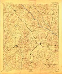
1892 Map of Abbeville
USGS Topo · Published 1913About this map
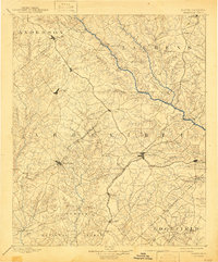
The Saluda River serves as a dominant natural boundary for this late nineteenth-century Piedmont landscape, separating the developing rail hubs of Abbeville and Greenwood from the surrounding rural uplands. This period is defined by the expansion of the Columbia and Greenville Railroad, which influenced the growth of interior junctions like Hodges and Donaldsville. Away from the rail corridors, the terrain remains deeply connected to its watercourses, evidenced by numerous milling operations such as Irwin Mill and Maddox Mill along the northern creeks. Local transit relied heavily on river crossings like Smith Ferry and Puckett Ferry, which connected the agricultural communities of Cokesburg and Waterloo. Notable landmarks including the prominent Parson Mtn. and the historic settlement of Ninety Six provide essential reference points for researchers tracing the early geography of the region before modern highway development changed the local travel patterns.
Find a feature on this map
86 named features on this map. Tap any name to fly to it.
Don’t see what you’re looking for? This feature index may not catch every label — zoom into the map to look around manually.
Map Details
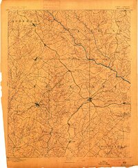
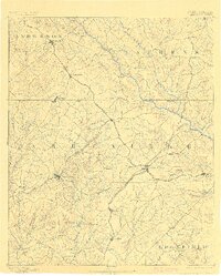
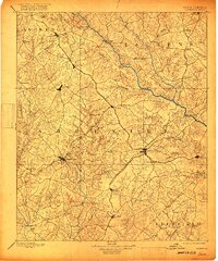
Editions of this 1892 Abbeville Map
6 editions found
Other maps of this area

1888 · Pickens
USGS Topo · 1:125,000

1892 · Mc Cormick
USGS Topo · 1:125,000

1892 · Abbeville
USGS Topo · 1:125,000

1893 · Elberton
USGS Topo · 1:125,000

1894 · Pickens
USGS Topo · 1:125,000

1906 · Crawfordville
USGS Topo · 1:125,000

1908 · Kirksey
USGS Topo · 1:24,000

1912 · Mc Cormick
USGS Topo · 1:125,000

1941 · Spartanburg
USGS Topo · 1:250,000

1948 · Abbeville East
USGS Topo · 1:24,000