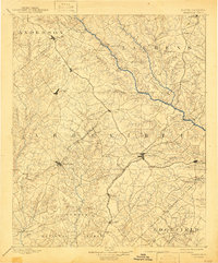
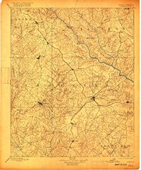
1892 Map of Abbeville
USGS Topo · Published 1943About this map
Abbeville and Greenwood serve as the primary hubs in this late 19th-century study of the South Carolina Piedmont, a landscape defined by an intricate network of river crossings and competing rail lines. The Saluda River forms a major geographic boundary, spanned at critical points by Smith Ferry, Puckett Ferry, and the Free Bridge. These crossings, alongside industrial sites like Irwin Mills and Douglas Mill, illustrate the river-driven economy of the era before modern infrastructure.
Find a feature on this map
78 named features on this map. Tap any name to fly to it.
Don’t see what you’re looking for? This feature index may not catch every label — zoom into the map to look around manually.
Map Details
Editions of this 1892 Abbeville Map
6 editions found
Other maps of this area

1888 · Pickens
USGS Topo · 1:125,000

1892 · Mc Cormick
USGS Topo · 1:125,000

1892 · Abbeville
USGS Topo · 1:125,000

1893 · Elberton
USGS Topo · 1:125,000

1894 · Pickens
USGS Topo · 1:125,000

1906 · Crawfordville
USGS Topo · 1:125,000

1908 · Kirksey
USGS Topo · 1:24,000

1912 · Mc Cormick
USGS Topo · 1:125,000

1941 · Spartanburg
USGS Topo · 1:250,000

1948 · Abbeville East
USGS Topo · 1:24,000