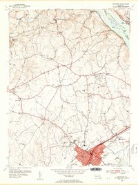
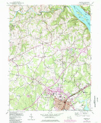
1953 Map of Aberdeen
USGS Topo · Published 1955About this map
Aberdeen serves as the primary hub of this Harford County landscape, shown here in the early 1950s as a thriving rail and transit crossroads. The Pennsylvania Railroad and the Baltimore and Ohio Railroad cut through the town, paralleling the Pulaski Highway and establishing a corridor of movement that defines the southern portion of the sheet. To the north, the terrain transitions into a patchwork of rural crossroads and family-named landmarks. The northern border is traced by Deer Creek and the Susquehanna River, where smaller communities like Lapidum and Rock Run overlook the water.
Find a feature on this map
80 named features on this map. Tap any name to fly to it.
Don’t see what you’re looking for? This feature index may not catch every label — zoom into the map to look around manually.
Map Details
Editions of this 1953 Aberdeen Map
5 editions found
Other maps of this area

1893 · Gunpowder
USGS Topo · 1:62,500

1898 · Tolchester
USGS Topo · 1:125,000

1900 · Havre De Grace
USGS Topo · 1:62,500

1900 · Betterton
USGS Topo · 1:62,500

1901 · Belair
USGS Topo · 1:62,500

1901 · Gunpowder
USGS Topo · 1:62,500

1903 · Tolchester
USGS Topo · 1:125,000

1908 · Tolchester
USGS Topo · 1:125,000

1941 · Gunpowder
USGS Topo · 1:62,500

1942 · Havre De Grace
USGS Topo · 1:62,500