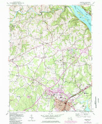
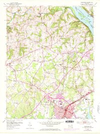
1953 Map of Aberdeen
USGS Topo · Published 1985About this map
The Susquehanna River and Deer Creek define the northern and eastern edges of this landscape, where the wooded slopes of Susquehanna State Park meet the industrial and military activity of mid-century Harford County. The town of Aberdeen serves as a major hub, its growth illustrated by the purple revisions marking urban expansion near the Ohio Railroad and Amtrak lines. Between the bustling center and the river, numerous small settlements like Aldino, Level, and Lapidum are connected by a network of rural roads such as Pulaski Highway.
Find a feature on this map
85 named features on this map. Tap any name to fly to it.
Don’t see what you’re looking for? This feature index may not catch every label — zoom into the map to look around manually.
Map Details
Editions of this 1953 Aberdeen Map
5 editions found
Other maps of this area

1893 · Gunpowder
USGS Topo · 1:62,500

1898 · Tolchester
USGS Topo · 1:125,000

1900 · Havre De Grace
USGS Topo · 1:62,500

1900 · Betterton
USGS Topo · 1:62,500

1901 · Belair
USGS Topo · 1:62,500

1901 · Gunpowder
USGS Topo · 1:62,500

1903 · Tolchester
USGS Topo · 1:125,000

1908 · Tolchester
USGS Topo · 1:125,000

1941 · Gunpowder
USGS Topo · 1:62,500

1942 · Havre De Grace
USGS Topo · 1:62,500