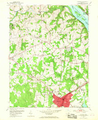
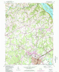
1953 Map of Aberdeen
USGS Topo · Published 1968About this map
Aberdeen serves as the primary hub of activity in this 1950s study of Harford County, Maryland, where the Pennsylvania Railroad and Baltimore and Ohio Railroad converge. The landscape is a network of rural settlements like Churchville, Level, and Earlton, connected by historic routes such as Old Post Road and the Pulaski Highway. Industry and infrastructure are well-represented by the Aberdeen Airpark, the sprawling U.S. Military Reservation Aberdeen Proving Grounds, and old milling sites including Noble Mill and Wilson Mill along the northern creeks.
Find a feature on this map
81 named features on this map. Tap any name to fly to it.
Don’t see what you’re looking for? This feature index may not catch every label — zoom into the map to look around manually.
Map Details
Editions of this 1953 Aberdeen Map
5 editions found
Other maps of this area

1893 · Gunpowder
USGS Topo · 1:62,500

1898 · Tolchester
USGS Topo · 1:125,000

1900 · Havre De Grace
USGS Topo · 1:62,500

1900 · Betterton
USGS Topo · 1:62,500

1901 · Belair
USGS Topo · 1:62,500

1901 · Gunpowder
USGS Topo · 1:62,500

1903 · Tolchester
USGS Topo · 1:125,000

1908 · Tolchester
USGS Topo · 1:125,000

1941 · Gunpowder
USGS Topo · 1:62,500

1942 · Havre De Grace
USGS Topo · 1:62,500