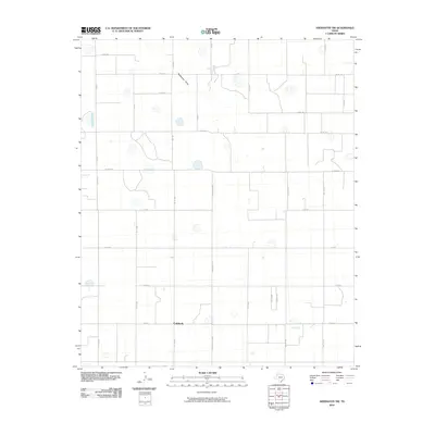
2010 Map of Abernathy SW
USGS Topo · Published 2010About this map
Caldwell serves as the primary named settlement in this pocket of the Texas High Plains, situated at the intersection of several farm and county roads. The landscape is defined by the ephemeral course of Blackwater Draw, which meanders across the northern portion of the quadrangle. The map illustrates a highly organized agricultural grid, where long stretches of roads like Frankford Ave and Quaker Ave bisect the terrain into large rectangular sections typical of Llano Estacado farming operations. Numerous small, scattered depressions or playas dot the surface, reflecting the local hydrology where surface water collects in this semi-arid region. For those tracing the evolution of regional transportation, the layout of Fm 2528 and various county roads such as Co Rd 325 provides a detailed view of how rural access was maintained during this era.
Find a feature on this map
28 named features on this map. Tap any name to fly to it.
Don’t see what you’re looking for? This feature index may not catch every label — zoom into the map to look around manually.
Map Details
Editions of this 2010 Abernathy SW Map
This is the sole edition of this map. No revisions or reprints were ever made.
Other maps of this area

1954 · Lubbock
USGS Topo · 1:250,000

1954 · Brownfield
USGS Topo · 1:250,000

1956 · Shallowater
USGS Topo · 1:24,000

1956 · New Deal
USGS Topo · 1:24,000

1957 · Lubbock
USGS Topo · 1:62,500

1957 · Anton
USGS Topo · 1:62,500

1957 · Abernathy
USGS Topo · 1:62,500

1957 · Wolfforth
USGS Topo · 1:62,500

1958 · Brownfield
USGS Topo · 1:250,000

1962 · Brownfield
USGS Topo · 1:250,000