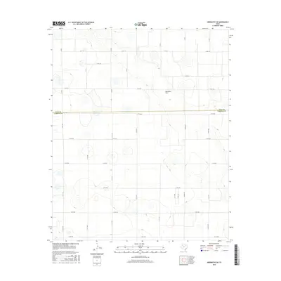
2016 Map of Abernathy SW
USGS Topo · Published 2016About this map
Blackwater Draw cuts across this High Plains landscape, serving as the primary natural drainage feature in an area otherwise defined by its rigid grid of agricultural roads. Located on the boundary between Hale and Lubbock counties, this 2016 survey illustrates the intersection of rural land management and expanding infrastructure. The map is dominated by a systematic network of county roads, such as Co Rd 5000 and Quaker Ave, which partition the terrain into distinct farming blocks. This pattern of land use is typical of the Llano Estacado, where the natural topography is subtle and the economy is driven by large-scale cultivation. Researchers will find a high density of small playa wetlands scattered throughout the plains, often bypassed by major transit routes like Fm 2528 as they provide vital seasonal drainage for the surrounding fields.
Find a feature on this map
29 named features on this map. Tap any name to fly to it.
Don’t see what you’re looking for? This feature index may not catch every label — zoom into the map to look around manually.
Map Details
Editions of this 2016 Abernathy SW Map
This is the sole edition of this map. No revisions or reprints were ever made.
Other maps of this area

1954 · Lubbock
USGS Topo · 1:250,000

1954 · Brownfield
USGS Topo · 1:250,000

1956 · Shallowater
USGS Topo · 1:24,000

1956 · New Deal
USGS Topo · 1:24,000

1957 · Lubbock
USGS Topo · 1:62,500

1957 · Anton
USGS Topo · 1:62,500

1957 · Abernathy
USGS Topo · 1:62,500

1957 · Wolfforth
USGS Topo · 1:62,500

1958 · Brownfield
USGS Topo · 1:250,000

1962 · Brownfield
USGS Topo · 1:250,000