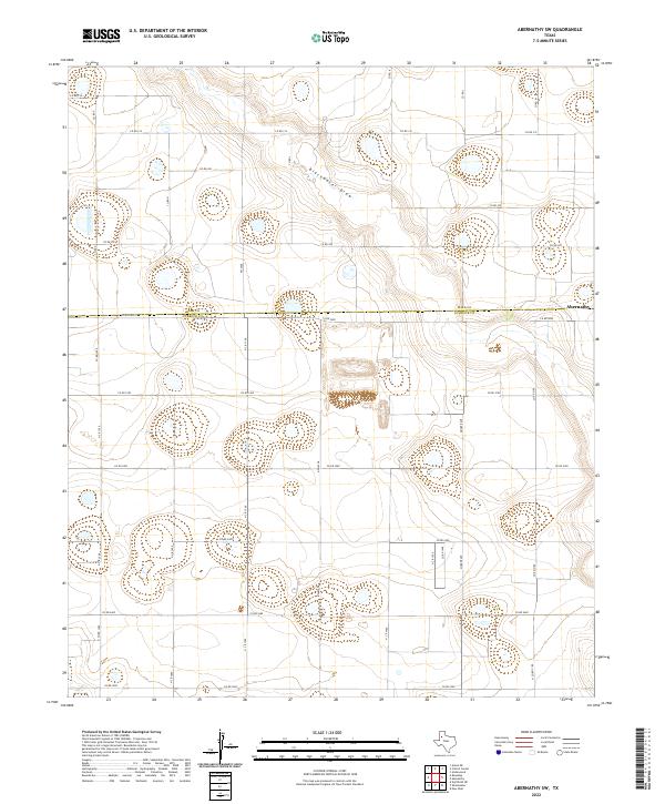
2022 Map of Abernathy SW
USGS Topo · Published 2022About this map
Blackwater Draw cuts across this high plains landscape, defining the topography north of the Lubbock Co and Hale Co line. The terrain is characterized by a high density of depressions and seasonal basins typical of the Llano Estacado, linked by a strictly surveyed grid of county roads. The settlement of Abernathy is positioned on the eastern edge of the quadrangle, serving as the primary hub for the surrounding agricultural tracts. Historically significant transportation corridors like Fm 2528 and Quaker Ave provide the north-south structure for the area's development. This 2022 survey documents the persistent rural character of the region, where land use remains focused on the expansive stretches between named routes like Co Rd 5000 and Co Rd 315.
Find a feature on this map
32 named features on this map. Tap any name to fly to it.
Don’t see what you’re looking for? This feature index may not catch every label — zoom into the map to look around manually.
Map Details
Editions of this 2022 Abernathy SW Map
This is the sole edition of this map. No revisions or reprints were ever made.
Other maps of this area

1954 · Lubbock
USGS Topo · 1:250,000

1954 · Brownfield
USGS Topo · 1:250,000

1956 · Shallowater
USGS Topo · 1:24,000

1956 · New Deal
USGS Topo · 1:24,000

1957 · Lubbock
USGS Topo · 1:62,500

1957 · Anton
USGS Topo · 1:62,500

1957 · Abernathy
USGS Topo · 1:62,500

1957 · Wolfforth
USGS Topo · 1:62,500

1958 · Brownfield
USGS Topo · 1:250,000

1962 · Brownfield
USGS Topo · 1:250,000