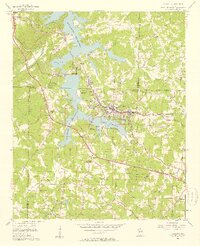
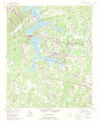
1956 Map of Acworth
USGS Topo · Published 1957About this map
Allatoona Reservoir dominates the landscape north of Acworth, its waters reaching into the deep valleys of Pumpkinvine Creek and Allatoona Creek. This mid-century survey captures a period of transition as the reservoir, which reached its normal pool elevation of 835 feet, reorganized the rural geography of Cobb County and Bartow County. The mapping shows the integration of older agricultural communities with new recreational spaces like the Lake Acworth Recreation Area. Evidence of long-standing rural life remains in the numerous small congregations and burial grounds, such as New Hope Ch and Mt Zion Cem, alongside signs of modern leisure like the Drive-in Theater near the town center. Transportation is anchored by the Nashville Chattanooga and St Louis RR, while a network of named country roads like Stilesboro Road and Burnt Hickory Road connect the outlying hills of Iron Hill and Mars Hill.
Find a feature on this map
60 named features on this map. Tap any name to fly to it.
Don’t see what you’re looking for? This feature index may not catch every label — zoom into the map to look around manually.
Map Details
Editions of this 1956 Acworth Map
6 editions found
Other maps of this area

1890 · Cartersville
USGS Topo · 1:125,000

1891 · Marietta
USGS Topo · 1:125,000

1891 · Cartersville
USGS Topo · 1:125,000

1895 · Marietta
USGS Topo · 1:125,000

1896 · Cartersville
USGS Topo · 1:125,000

1897 · Marietta
USGS Topo · 1:125,000

1901 · Marietta
USGS Topo · 1:125,000

1906 · Stilesboro
USGS Topo · 1:62,500

1907 · Acworth
USGS Topo · 1:62,500

1908 · Stilesboro
USGS Topo · 1:62,500