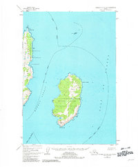
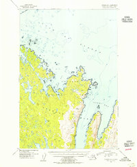
1952 Map of Afognak A-0 and B-0
USGS Topo · Published 1982About this map
Marmot Island and the eastern fringes of Afognak Island define this coastal survey, where the terrestrial landscape is entirely encompassed by the Chugach National Forest. The map documents a maritime environment of dramatic headlands, including Tonki Cape and Cape St Hermogenes, separated by the deep waters of Marmot Strait.
Find a feature on this map
20 named features on this map. Tap any name to fly to it.
Don’t see what you’re looking for? This feature index may not catch every label — zoom into the map to look around manually.
Map Details
Editions of this 1952 Afognak A-0 and B-0 Map
2 editions found
Other maps of this area

1952 · Afognak
USGS Topo · 1:250,000

1952 · Afognak A-1
USGS Topo · 1:63,360

1952 · Afognak B-1
USGS Topo · 1:63,360
1952 · Afognak A-0 and B-0
USGS Topo · 1:63,360
1953 · Afognak A-1
USGS Topo · 1:63,360
1953 · Afognak A-0 and B-0
USGS Topo · 1:63,360
1954 · Afognak B-1
USGS Topo · 1:63,360
2021 · Afognak B-0 SW
USGS Topo · 1:25,000
2021 · Afognak B-0 SE
USGS Topo · 1:25,000
2021 · Afognak A-0 NE
USGS Topo · 1:25,000