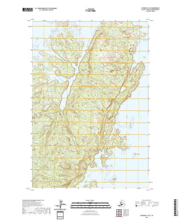
2021 Map of Afognak C-2 SE
USGS Topo · Published 2021About this map
Shangin Bay and Andrean Bay deeply indent the western shoreline of this coastal stretch on Kodiak Island, illustrating the intricate marine geography of the northern archipelago. The terrain is characterized by a series of dramatic peninsulas and sheltered inlets, including the prominent Tetrakof Point which extends into the surrounding waters. Small, named landforms like Ermine Island and Little Fort Island dot the coastline, serving as critical landmarks for maritime navigation along the Gulf of Alaska. The interior landscape is defined by steep elevation changes and complex drainage patterns that feed into Back Bay at the northern edge. This 2021 update by the U.S. Geological Survey provides a precise record of these shifting coastal features and the underlying Public Land Survey System boundaries, including the intersections of t18s r19w and t19s r19w.
Find a feature on this map
11 named features on this map. Tap any name to fly to it.
Don’t see what you’re looking for? This feature index may not catch every label — zoom into the map to look around manually.
Map Details
Editions of this 2021 Afognak C-2 SE Map
This is the sole edition of this map. No revisions or reprints were ever made.
Other maps of this area

1952 · Afognak
USGS Topo · 1:250,000

1952 · Afognak C-1 and C-2
USGS Topo · 1:63,360
1952 · Afognak C-2 and C-3
USGS Topo · 1:63,360

1952 · Afognak B-2
USGS Topo · 1:63,360

1952 · Afognak B-1
USGS Topo · 1:63,360
1954 · Afognak C-2 and C-3
USGS Topo · 1:63,360

1954 · Afognak B-2
USGS Topo · 1:63,360
1954 · Afognak C-1 and C-2
USGS Topo · 1:63,360
1954 · Afognak B-1
USGS Topo · 1:63,360
2021 · Afognak B-2 NE
USGS Topo · 1:25,000