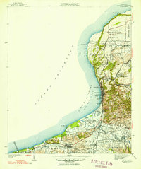
1942 Map of Aguadilla
USGS Topo · Published 1952About this map
Iglesia Aguadilla and the urban core of Aguadilla anchor this mid-century survey of Puerto Rico's northwestern coastline. The landscape is defined by the sharp transition from the coastal flats of the Bahia de Aguadilla to the steep limestone terrain of the Cerros Asomante. Large tracts of land are dedicated to the Reservación Militar in the north, while the southern reaches near Aguada show a dense network of watercourses like the Rio Guayabo and Caño Madre Vieja. The industrial footprint of the era is evident in the American Railroad line, which skirts the coast to serve settlements such as Coloso and Victoria. Local landmarks including the Acueducto and Parque de Colon offer specific points of interest for those tracing the historical development of these coastal municipios before modern expansion reshaped the shoreline.
Find a feature on this map
55 named features on this map. Tap any name to fly to it.
Don’t see what you’re looking for? This feature index may not catch every label — zoom into the map to look around manually.
Map Details
Editions of this 1942 Aguadilla Map
5 editions found
Other maps of this area

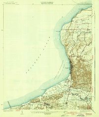
1937 · Aguadilla
USGS Topo · 1:20,000

1937 · Moca
USGS Topo · 1:20,000

1938 · Alto Sano
USGS Topo · 1:20,000

1941 · Moca
USGS Topo · 1:30,000

1941 · Rincon
USGS Topo · 1:30,000

1941 · Rincon
USGS Topo · 1:30,000

1941 · Isabela
USGS Topo · 1:30,000

1942 · Moca
USGS Topo · 1:30,000

1942 · Central La Plata
USGS Topo · 1:30,000

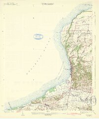
1942 · Aguadilla
USGS Topo · 1:30,000