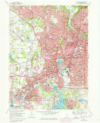
1967 Map of Akron West
USGS Topo · Published 1978About this map
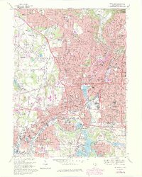
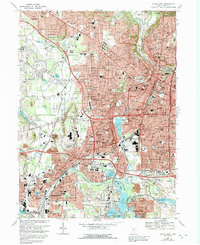
Industrial and residential expansion defines this mid-century landscape where the historic Ohio Canal corridor meets the modern reach of Conrail tracks. In Akron, the density of parochial schools and cemeteries, such as Akron Hebrew Cem and Holy Cross Cem, reflects the city's established immigrant and religious communities. The transition from the urban core of West Akron and Kenmore toward the lake country to the south shows a geography heavily influenced by both natural waterways and heavy engineering. The presence of Union Station and numerous factories along the Tuscarawas River illustrates the city's role as a major manufacturing hub. Farther south, the recreation-focused environment of the Portage Lakes and Long Lake provides a sharp contrast to the gravel pits and industrial zones found near Barberton.
Find a feature on this map
137 named features on this map. Tap any name to fly to it.
Don’t see what you’re looking for? This feature index may not catch every label — zoom into the map to look around manually.
Map Details
Editions of this 1967 Akron West Map
6 editions found
Other maps of this area

1901 · Massillon
USGS Topo · 1:62,500

1901 · Canton
USGS Topo · 1:62,500

1903 · Massillon
USGS Topo · 1:62,500

1903 · Canton
USGS Topo · 1:62,500

1903 · Akron
USGS Topo · 1:62,500

1905 · Akron
USGS Topo · 1:62,500

1906 · Kent
USGS Topo · 1:62,500

1950 · Cleveland
USGS Topo · 1:250,000

1951 · Canton
USGS Topo · 1:250,000

1953 · Canton
USGS Topo · 1:250,000