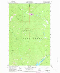
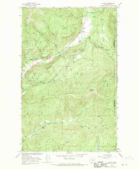
1967 Map of Aladdin Mtn
USGS Topo · Published 1982About this map
Aladdin Mountain and Seldom Seen Mountain dominate this section of the Colville National Forest, where the landscape is defined by the resource extraction and timber industries of the late 1960s. Mining activity is evident throughout the terrain, including the Lasota Mine in the north and the Middleport Mine situated near the base of Thomas Mtn. These operations are connected by a network of unimproved roads and a Jeep Trail, illustrating the remote nature of work in the Selkirk foothills before more modern infrastructure arrived.
Find a feature on this map
34 named features on this map. Tap any name to fly to it.
Don’t see what you’re looking for? This feature index may not catch every label — zoom into the map to look around manually.
Map Details
Editions of this 1967 Aladdin Mtn Map
4 editions found
Other maps of this area

1929 · Colville
USGS Topo · 1:125,000

1933 · Colville
USGS Topo · 1:125,000

1934 · Metaline
USGS Topo · 1:125,000

1942 · Metaline
USGS Topo · 1:125,000

1952 · Spirit
USGS Topo · 1:24,000

1952 · Deep Lake
USGS Topo · 1:24,000

1952 · Aladdin
USGS Topo · 1:24,000

1958 · Sandpoint
USGS Topo · 1:250,000

1963 · Sandpoint
USGS Topo · 1:250,000
1966 · Aladdin
USGS Topo · 1:24,000