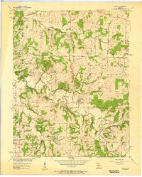
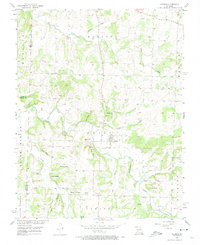
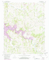
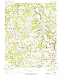
1956 Map of Aldrich
USGS Topo · Published 1957About this map
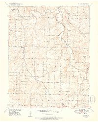
The Little Sac River meanders through this portion of Missouri, carving a path between steep landmarks like Blair Bluff, Tommy Bluff, and Cedar Bluff. The landscape is defined by its agrarian and spiritual centers, anchored by the settlement of Aldrich and the nearby Bungalow Hill. The abundance of small family and community burial grounds, such as Akard Cem, Henderson Cem, and Shady Grove Cem, suggests a deeply rooted rural population organized around localized landmarks and township lines.
Find a feature on this map
38 named features on this map. Tap any name to fly to it.
Don’t see what you’re looking for? This feature index may not catch every label — zoom into the map to look around manually.
Map Details
Editions of this 1956 Aldrich Map
3 editions found
Other maps of this area

1884 · Springfield
USGS Topo · 1:125,000

1884 · Bolivar
USGS Topo · 1:125,000

1886 · Stockton
USGS Topo · 1:125,000

1886 · Greenfield
USGS Topo · 1:125,000

1886 · Springfield
USGS Topo · 1:125,000

1888 · Greenfield
USGS Topo · 1:125,000

1892 · Bolivar
USGS Topo · 1:125,000
1950 · Cliquot
USGS Topo · 1:24,000
1951 · Cliquot
USGS Topo · 1:24,000

1954 · Springfield
USGS Topo · 1:250,000