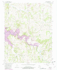
1956 Map of Aldrich
USGS Topo · Published 1982About this map
The Stockton Lake reservoir dominates this landscape, its waters reaching into the deep hollows of the Sac River and Little Sac River systems. At the center of the sheet, the village of Aldrich sits at the edge of the expanded shoreline, near landmarks like Bungalow Hill and the High Point Public Use Area. The geography reflects the transition of the river valley following the creation of the lake, though many older rural indicators remain. Genealogists will find a wealth of local history preserved in the numerous family and community burial grounds, including Akard Cem, Trimble Cem, and Henderson Cem. The upland areas are marked by distinct topographical features such as Tommy Bluff and Turkey Knob, while the community’s spiritual life is centered at Pleasant Ridge Ch and Campground Ch.
Find a feature on this map
44 named features on this map. Tap any name to fly to it.
Don’t see what you’re looking for? This feature index may not catch every label — zoom into the map to look around manually.
Map Details
Editions of this 1956 Aldrich Map
3 editions found
Other maps of this area

1884 · Springfield
USGS Topo · 1:125,000

1884 · Bolivar
USGS Topo · 1:125,000

1886 · Stockton
USGS Topo · 1:125,000

1886 · Greenfield
USGS Topo · 1:125,000

1886 · Springfield
USGS Topo · 1:125,000

1888 · Greenfield
USGS Topo · 1:125,000

1892 · Bolivar
USGS Topo · 1:125,000

1950 · Cliquot
USGS Topo · 1:24,000
1951 · Cliquot
USGS Topo · 1:24,000

1954 · Springfield
USGS Topo · 1:250,000