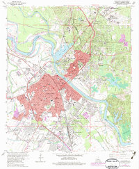
1972 Map of Alexandria
USGS Topo · Published 1979About this map
The Red River divides the urban landscape of central Louisiana, with Alexandria anchoring the southern bank and Pineville the northern. This era shows a community defined by its massive state and regional institutions, from the sprawling campus of Central Louisiana State Hospital and Louisiana College in Pineville to the VA Hospital near Lake Buhlow. To the northeast, the military footprint of Camp Beauregard is prominent, while the river's influence is seen in the extensive levee system and industrial sites like the Alexandria Junc Mill.
Find a feature on this map
109 named features on this map. Tap any name to fly to it.
Don’t see what you’re looking for? This feature index may not catch every label — zoom into the map to look around manually.
Map Details
Editions of this 1972 Alexandria Map
4 editions found
Other maps of this area

1932 · Boyce NE
USGS Topo · 1:31,680

1935 · Lecompte
USGS Topo · 1:62,500

1941 · Alexandria
USGS Topo · 1:62,500

1941 · Boyce
USGS Topo · 1:62,500

1945 · Boyce SE
USGS Topo · 1:31,680

1949 · Boyce SE
USGS Topo · 1:31,680

1953 · Alexandria
USGS Topo · 1:250,000

1955 · Alexandria
USGS Topo · 1:250,000

1956 · Forest Hill
USGS Topo · 1:62,500

1956 · Boyce
USGS Topo · 1:62,500