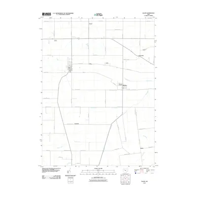
2010 Map of Alger
USGS Topo · Published 2010About this map
Alger and McGuffey anchor this rural Hardin County landscape, where the agricultural grid is deeply etched by a complex system of drainage infrastructure. The presence of Cottonwood Ditch, Cooney Ditch, and the channelized Scioto River reveals a history of land reclamation essential for farming the fertile black soils of the former Scioto Marsh. These engineered waterways intersect with a dense network of county and township roads that define the region's rectilinear layout.
Find a feature on this map
49 named features on this map. Tap any name to fly to it.
Don’t see what you’re looking for? This feature index may not catch every label — zoom into the map to look around manually.
Map Details
Editions of this 2010 Alger Map
This is the sole edition of this map. No revisions or reprints were ever made.
Other maps of this area

1905 · Arlington
USGS Topo · 1:62,500

1907 · Bluffton
USGS Topo · 1:62,500

1907 · Arlington
USGS Topo · 1:24,000

1913 · Alger
USGS Topo · 1:48,000

1915 · Alger
USGS Topo · 1:62,500

1915 · Kenton
USGS Topo · 1:62,500

1943 · Alger
USGS Topo · 1:62,500

1944 · Kenton
USGS Topo · 1:62,500

1950 · Marion
USGS Topo · 1:250,000
1960 · Roundhead
USGS Topo · 1:24,000