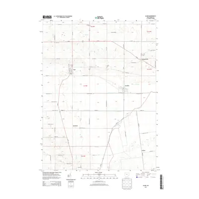
2013 Map of Alger
USGS Topo · Published 2013About this map
The Scioto River headwaters region in Hardin County is defined by a dense network of drainage engineering, including the Cottonwood Ditch and Cooney Ditch, which support the agricultural productivity of the surrounding townships. The village of Alger serves as a central hub, where N Main St and Oh-235 intersect near the local Po. The map documents numerous smaller settlements and neighborhood clusters such as Quickstep, McGuffey, and Walton, each connected by a grid of county roads and township highways.
Find a feature on this map
100 named features on this map. Tap any name to fly to it.
Don’t see what you’re looking for? This feature index may not catch every label — zoom into the map to look around manually.
Map Details
Editions of this 2013 Alger Map
This is the sole edition of this map. No revisions or reprints were ever made.
Other maps of this area

1905 · Arlington
USGS Topo · 1:62,500

1907 · Bluffton
USGS Topo · 1:62,500

1907 · Arlington
USGS Topo · 1:24,000

1913 · Alger
USGS Topo · 1:48,000

1915 · Alger
USGS Topo · 1:62,500

1915 · Kenton
USGS Topo · 1:62,500

1943 · Alger
USGS Topo · 1:62,500

1944 · Kenton
USGS Topo · 1:62,500

1950 · Marion
USGS Topo · 1:250,000
1960 · Roundhead
USGS Topo · 1:24,000