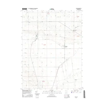
2016 Map of Alger
USGS Topo · Published 2016About this map
Alger and McGuffey anchor this agrarian landscape in western Hardin County, where the headwaters of the Scioto River begin their journey. The terrain is characterized by an extensive network of drainage infrastructure, including Cottonwood Ditch, Cooney Ditch, and Twin Branches, reflecting the region's history of reclaiming marshland for productive cultivation. Small settlements like Huntersville and Walton are connected by a grid of township and county roads, such as Van Atta Rd and Tyler Rd. Local family history is preserved in several rural burial grounds scattered across the townships, including Preston Cem, Shadley Cem, and Carman Cem. The map illustrates the geometric precision of the Public Land Survey System, with clearly marked section lines and township boundaries like t4s r9e defining the movement of people and property across this corner of Ohio.
Find a feature on this map
98 named features on this map. Tap any name to fly to it.
Don’t see what you’re looking for? This feature index may not catch every label — zoom into the map to look around manually.
Map Details
Editions of this 2016 Alger Map
This is the sole edition of this map. No revisions or reprints were ever made.
Other maps of this area

1905 · Arlington
USGS Topo · 1:62,500

1907 · Bluffton
USGS Topo · 1:62,500

1907 · Arlington
USGS Topo · 1:24,000

1913 · Alger
USGS Topo · 1:48,000

1915 · Alger
USGS Topo · 1:62,500

1915 · Kenton
USGS Topo · 1:62,500

1943 · Alger
USGS Topo · 1:62,500

1944 · Kenton
USGS Topo · 1:62,500

1950 · Marion
USGS Topo · 1:250,000
1960 · Roundhead
USGS Topo · 1:24,000