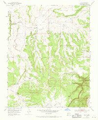
1953 Map of Alire
USGS Topo · Published 1968About this map
Alire stands at the center of this 1950s high-desert landscape in Northern New Mexico, situated along the upper reaches of the Arroyo Blanco. The settlement is marked by its small local Cem, indicating a long-standing family presence in the area before the modernization of the mid-20th century. The terrain is defined by dramatic changes in elevation, transitioning from the deep Cañon de los Tanques up to the broad expanse of Mesa de los Viejos.
Find a feature on this map
17 named features on this map. Tap any name to fly to it.
Don’t see what you’re looking for? This feature index may not catch every label — zoom into the map to look around manually.
Map Details
Editions of this 1953 Alire Map
4 editions found
Other maps of this area

1909 · Gallina
USGS Topo · 1:125,000

1918 · Abiquiu
USGS Topo · 1:125,000

1918 · Tusas
USGS Topo · 1:125,000

1953 · Alire
USGS Topo · 1:24,000

1953 · Echo Ampitheater
USGS Topo · 1:24,000

1953 · Canjilon
USGS Topo · 1:24,000

1953 · Laguna Peak
USGS Topo · 1:24,000

1953 · Navajo Peak
USGS Topo · 1:24,000

1953 · Ghost Ranch
USGS Topo · 1:24,000

1954 · Aztec
USGS Topo · 1:250,000