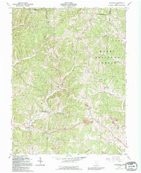
1992 Map of Allensville
USGS Topo · Published 1994About this map
Allensville and the winding valleys of the Wayne National Forest define this landscape on the Hocking and Vinton County line. The settlement pattern is largely dictated by the complex drainage of the Middle Fork and Salt Creek, with small communities like Stella and Royal situated along the narrow valley floors. The map reveals a deeply rooted rural society through its high density of family and community landmarks, particularly the string of cemeteries such as Bell Cem, Garrett Cem, and Wolf Cem that follow the ridgelines and hollows.
Find a feature on this map
40 named features on this map. Tap any name to fly to it.
Don’t see what you’re looking for? This feature index may not catch every label — zoom into the map to look around manually.
Map Details
Editions of this 1992 Allensville Map
This is the sole edition of this map. No revisions or reprints were ever made.
Other maps of this area

1904 · Zaleski
USGS Topo · 1:62,500

1905 · Wilkesville
USGS Topo · 1:62,500

1907 · Zaleski
USGS Topo · 1:62,500

1908 · Wilkesville
USGS Topo · 1:62,500

1910 · Laurelville
USGS Topo · 1:62,500

1912 · Laurelville
USGS Topo · 1:62,500

1913 · Jackson
USGS Topo · 1:62,500

1944 · Jackson
USGS Topo · 1:62,500

1944 · Laurelville
USGS Topo · 1:62,500

1947 · Columbus
USGS Topo · 1:250,000