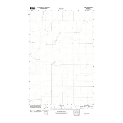
2011 Map of Almira SW
USGS Topo · Published 2011About this map
Wilson Creek meanders through this agricultural landscape in Grant County, providing a vital water source for the surrounding plateaus. The 2011 survey reveals a highly organized grid of rural roads, many bearing the names of local families who shaped the region's farming heritage. Routes like Peha Rd E, Monson Rd E, and Christensen Rd divide the land into large-scale cultivation plots, reflecting the modern grain-farming operations typical of Central Washington. The drainage patterns of the creek and its ephemeral tributaries contrast with the rigid lines of human development. This layout, including landmarks such as Tolonen Rd E and Buddrius Rd N, illustrates how later twentieth-century land management maintained the homesteading divisions established generations prior while adapting to the needs of industrial-scale dryland agriculture.
Find a feature on this map
20 named features on this map. Tap any name to fly to it.
Don’t see what you’re looking for? This feature index may not catch every label — zoom into the map to look around manually.
Map Details
Editions of this 2011 Almira SW Map
This is the sole edition of this map. No revisions or reprints were ever made.
Other maps of this area

1953 · Ritzville
USGS Topo · 1:250,000

1956 · Wilson Creek
USGS Topo · 1:62,500

1959 · Ritzville
USGS Topo · 1:250,000

1965 · Ritzville
USGS Topo · 1:250,000

1968 · Hartline
USGS Topo · 1:24,000

1968 · Marlin
USGS Topo · 1:24,000

1968 · Hartline SE
USGS Topo · 1:24,000

1968 · Sullivan Lake
USGS Topo · 1:24,000

1969 · Almira
USGS Topo · 1:24,000

1969 · Almira SE
USGS Topo · 1:24,000