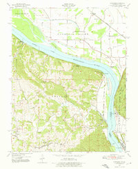
1947 Map of Altenburg
USGS Topo · Published 1976About this map
The Mississippi River cuts a wide path through this landscape, separating the rugged bluffs of Perry County, Missouri, from the lowlands of Jackson County, Illinois. The river's influence is evident in the numerous landings and islands, such as Leimbach Landing and Lacours Island, which served the local river economy. On the Missouri side, German heritage is anchored in the settlements of Altenburg, Frohna, and Wittenberg, where narrow valleys like Boone Hollow and Sawmill Hollow drain toward the river. Transportation networks define the Illinois side, with the Missouri Pacific and Illinois Central railroads navigating the flat terrain beneath the massive Fountain Bluff. Distinctive landmarks like Tower Rock in the river and the Power Plant at Grand Tower highlight the blend of natural geological features and industrial development that characterizes this stretch of the river valley in the late 1940s.
Find a feature on this map
45 named features on this map. Tap any name to fly to it.
Don’t see what you’re looking for? This feature index may not catch every label — zoom into the map to look around manually.
Map Details
Editions of this 1947 Altenburg Map
4 editions found
Other maps of this area

1910 · Murphysboro
USGS Topo · 1:62,500

1916 · Campbell Hill
USGS Topo · 1:62,500

1918 · Altenburg
USGS Topo · 1:62,500

1918 · Campbell Hill
USGS Topo · 1:62,500

1924 · Alto Pass
USGS Topo · 1:62,500

1925 · Altenburg
USGS Topo · 1:62,500

1938 · Murphysboro
USGS Topo · 1:62,500

1947 · Alto Pass
USGS Topo · 1:62,500

1947 · Crosstown
USGS Topo · 1:24,000

1947 · Oak Ridge
USGS Topo · 1:24,000