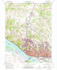
1954 Map of Alton
USGS Topo · Published 1975About this map
The Mississippi River defines the southwestern edge of this landscape, its waters slowed by Lock and Dam No 26 near Ellis Island. The city of Alton serves as a dense industrial and transport hub, where the river's path meets a complex network of rail lines including the Gulf Mobile and Ohio Railroad and the Burlington Northern. Settlement extends northward into North Alton and Godfrey, where Lewis and Clark Community College occupies a prominent campus.
Find a feature on this map
66 named features on this map. Tap any name to fly to it.
Don’t see what you’re looking for? This feature index may not catch every label — zoom into the map to look around manually.
Map Details
Editions of this 1954 Alton Map
4 editions found
Other maps of this area

1925 · Brighton
USGS Topo · 1:62,500

1927 · Alton
USGS Topo · 1:62,500

1927 · St. Charles
USGS Topo · 1:62,500

1928 · Brighton
USGS Topo · 1:62,500

1930 · Jerseyville
USGS Topo · 1:62,500

1933 · Jerseyville
USGS Topo · 1:62,500

1933 · Saint Charles
USGS Topo · 1:62,500

1934 · Alton
USGS Topo · 1:62,500

1935 · Florissant
USGS Topo · 1:24,000

1935 · Columbia Bottom
USGS Topo · 1:24,000