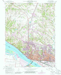
1954 Map of Alton
USGS Topo · Published 1986About this map
The Mississippi River defines the industrial and geographic character of this riverfront landscape, where the Lock and Dam No 26 and the Clark Bridge facilitate movement across the water toward Portage Des Sioux. On the Illinois side, the city of Alton climbs the bluffs with a dense network of civic and religious institutions, including State House Square, the Ursuline Convent, and numerous healthcare facilities like Alton Memorial Hospital.
Find a feature on this map
59 named features on this map. Tap any name to fly to it.
Don’t see what you’re looking for? This feature index may not catch every label — zoom into the map to look around manually.
Map Details
Editions of this 1954 Alton Map
4 editions found
Other maps of this area

1925 · Brighton
USGS Topo · 1:62,500

1927 · Alton
USGS Topo · 1:62,500

1927 · St. Charles
USGS Topo · 1:62,500

1928 · Brighton
USGS Topo · 1:62,500

1930 · Jerseyville
USGS Topo · 1:62,500

1933 · Jerseyville
USGS Topo · 1:62,500

1933 · Saint Charles
USGS Topo · 1:62,500

1934 · Alton
USGS Topo · 1:62,500

1935 · Florissant
USGS Topo · 1:24,000

1935 · Columbia Bottom
USGS Topo · 1:24,000