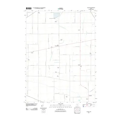
2010 Map of Alvada
USGS Topo · Published 2010About this map
West Independence and Alvada anchor this rural landscape in Hancock County, Ohio, as it appeared in the early 21st century. The geography is defined by a grid of township and county roads that navigate the drainage basins of Wolf Creek and the East Branch Portage River. The map reveals a high density of small burial grounds, including the Wells Family Cemetery, Enon Valley Cemetery, and Big Spring Cemetery, which are essential for genealogical research in this part of the state.
Find a feature on this map
40 named features on this map. Tap any name to fly to it.
Don’t see what you’re looking for? This feature index may not catch every label — zoom into the map to look around manually.
Map Details
Editions of this 2010 Alvada Map
This is the sole edition of this map. No revisions or reprints were ever made.
Other maps of this area

1901 · Fostoria
USGS Topo · 1:62,500

1903 · Fostoria
USGS Topo · 1:62,500

1903 · Findlay
USGS Topo · 1:62,500

1905 · Arlington
USGS Topo · 1:62,500

1907 · Arlington
USGS Topo · 1:24,000

1907 · Upper Sandusky
USGS Topo · 1:62,500

1950 · Marion
USGS Topo · 1:250,000

1956 · Toledo
USGS Topo · 1:250,000

1960 · Bloomdale
USGS Topo · 1:24,000
1960 · Bascom
USGS Topo · 1:24,000