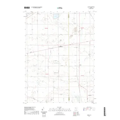
2019 Map of Alvada
USGS Topo · Published 2019About this map
The agricultural landscape of Hancock and Seneca counties unfolds across this survey, centered on the unincorporated community of Alvada. This portion of northwest Ohio is defined by a dense grid of township and county roads that navigate the headwaters of the E Br Portage River and The Outlet. Small settlements like West Independence and Springville serve as local anchors, while the Fostoria Reservoir marks the northern edge of the map. For family historians, the sheet is particularly valuable for its mapping of numerous local burial sites, including the Wells Family Cem, Enon Valley Cem, and Big Spring Cem. The presence of Diebleys Airport amidst the farm fields reflects the area's continued reliance on local infrastructure for transport and crop management in this late-decade update.
Find a feature on this map
65 named features on this map. Tap any name to fly to it.
Don’t see what you’re looking for? This feature index may not catch every label — zoom into the map to look around manually.
Map Details
Editions of this 2019 Alvada Map
This is the sole edition of this map. No revisions or reprints were ever made.
Other maps of this area

1901 · Fostoria
USGS Topo · 1:62,500

1903 · Fostoria
USGS Topo · 1:62,500

1903 · Findlay
USGS Topo · 1:62,500

1905 · Arlington
USGS Topo · 1:62,500

1907 · Arlington
USGS Topo · 1:24,000

1907 · Upper Sandusky
USGS Topo · 1:62,500

1950 · Marion
USGS Topo · 1:250,000

1956 · Toledo
USGS Topo · 1:250,000

1960 · Bloomdale
USGS Topo · 1:24,000
1960 · Bascom
USGS Topo · 1:24,000