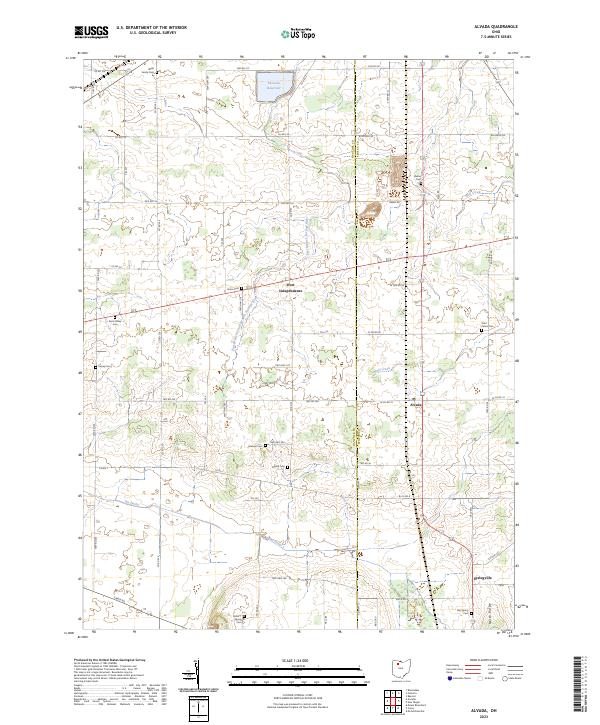
2023 Map of Alvada
USGS Topo · Published 2023About this map
West Independence and the nearby village of Alvada anchor this portion of the Northwest Ohio landscape, where the flat terrain is defined by a dense grid of township roads and agricultural drainages. Water management is a primary feature of the geography, evidenced by the Fostoria Reservoir in the north and the channelized watercourse known as The Outlet in the south. These features, along with the East Branch Portage River and Wolf Creek, reflect the region's historic efforts to drain the Great Black Swamp for cultivation.
Find a feature on this map
44 named features on this map. Tap any name to fly to it.
Don’t see what you’re looking for? This feature index may not catch every label — zoom into the map to look around manually.
Map Details
Editions of this 2023 Alvada Map
This is the sole edition of this map. No revisions or reprints were ever made.
Other maps of this area

1901 · Fostoria
USGS Topo · 1:62,500

1903 · Fostoria
USGS Topo · 1:62,500

1903 · Findlay
USGS Topo · 1:62,500

1905 · Arlington
USGS Topo · 1:62,500

1907 · Arlington
USGS Topo · 1:24,000

1907 · Upper Sandusky
USGS Topo · 1:62,500

1950 · Marion
USGS Topo · 1:250,000

1956 · Toledo
USGS Topo · 1:250,000

1960 · Bloomdale
USGS Topo · 1:24,000
1960 · Bascom
USGS Topo · 1:24,000