
1961 Map of Alvarado
USGS Topo · Published 1963About this map
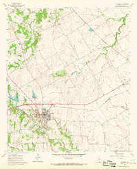
Alvarado serves as a major transportation junction in Johnson County, where the crossing of the Gulf Colorado and Santa Fe and the Missouri Kansas Texas railroads anchored the town's growth. This 1961 field-checked survey reveals a landscape of small rural communities and family landmarks, such as Pleasant Point and the Happy Hill settlement. The town core includes the Geo Washington Carver school and Glenwood Cemetery, while the surrounding prairie is dotted with country houses of worship like Willow Springs Ch and Cahill Ch.
Find a feature on this map
30 named features on this map. Tap any name to fly to it.
Don’t see what you’re looking for? This feature index may not catch every label — zoom into the map to look around manually.
Map Details
Editions of this 1961 Alvarado Map
3 editions found
Other maps of this area

1891 · Cleburne
USGS Topo · 1:125,000

1894 · Cleburne
USGS Topo · 1:125,000

1894 · Fort Worth
USGS Topo · 1:125,000

1954 · Dallas
USGS Topo · 1:250,000

1955 · Burleson
USGS Topo · 1:24,000

1958 · Dallas
USGS Topo · 1:250,000

1959 · Britton
USGS Topo · 1:24,000

1959 · Mansfield
USGS Topo · 1:24,000
1959 · Arlington
USGS Topo · 1:62,500

1960 · Keene
USGS Topo · 1:24,000