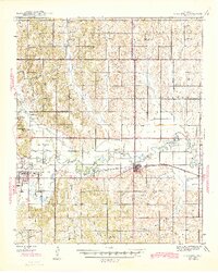
1945 Map of Anadarko
USGS Topo · Published 1945About this map
Anadarko serves as the regional hub in this mid-century Oklahoma landscape, situated where Tonkawa Creek meets the Washita River. The map highlights the significant institutional presence of the Kiowa Indian Agency and the Riverside Indian School northwest of the town center. The transportation network is defined by the Chicago Rock Island and Pacific railroad, which parallels the river through Verden. This survey reveals a dense rural infrastructure of one-room schoolhouses and community churches, such as Elderberry Sch and Wichita Mission Ch, which were the social anchors for farming families in townships like Shirley and Delaware. The terrain transitions from the river valley to the South Hills, showing a patchwork of section lines that organized the land into a productive agricultural grid.
Find a feature on this map
56 named features on this map. Tap any name to fly to it.
Don’t see what you’re looking for? This feature index may not catch every label — zoom into the map to look around manually.
Map Details
Editions of this 1945 Anadarko Map
2 editions found
Other maps of this area

1893 · Buggy Creek
USGS Topo · 1:62,500

1893 · Minco
USGS Topo · 1:62,500

1902 · Rush Springs
USGS Topo · 1:125,000

1904 · Chickasha
USGS Topo · 1:125,000

1945 · Anadarko
USGS Topo · 1:62,500

1949 · Cement
USGS Topo · 1:62,500

1949 · Rush Springs
USGS Topo · 1:62,500

1950 · Rush Springs
USGS Topo · 1:62,500

1951 · Binger
USGS Topo · 1:62,500

1951 · Fort Cobb
USGS Topo · 1:62,500