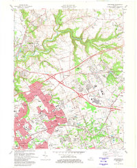
1981 Map of Anchorage
USGS Topo · Published 1982About this map
Anchorage and its surrounding suburbs exhibit a landscape of maturing residential growth and institutional landmarks in the early 1980s. The map illustrates the sprawling footprint of St Matthews and Lyndon as they transition from historic railway hubs to major population centers. Substantial tracts of land are dedicated to public health and education, most notably the Central State Hospital complex and the St Thomas-St Vincent Home. This era represents a peak for the Kentucky Railway Museum at its former site, reflecting the region's deep connection to the Louisville and Nashville railroad.
Find a feature on this map
106 named features on this map. Tap any name to fly to it.
Don’t see what you’re looking for? This feature index may not catch every label — zoom into the map to look around manually.
Map Details
Editions of this 1981 Anchorage Map
2 editions found
Other maps of this area

1905 · Prospect
USGS Topo · 1:62,500

1907 · Louisville
USGS Topo · 1:62,500

1912 · Prospect
USGS Topo · 1:62,500

1929 · Taylorsville
USGS Topo · 1:62,500

1932 · La Grange
USGS Topo · 1:62,500

1937 · Jeffersonville
USGS Topo · 1:24,000

1937 · Charlestown
USGS Topo · 1:24,000

1938 · Owen
USGS Topo · 1:24,000

1946 · Jeffersonville
USGS Topo · 1:24,000

1948 · Owen
USGS Topo · 1:24,000