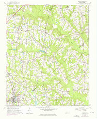
1964 Map of Angier
USGS Topo · Published 1975About this map
Angier anchors the southern portion of this landscape at the junction of Harnett, Wake, and Johnston counties during the mid-1960s. The town's grid and industrial footprint are defined by the Norfolk Southern railroad line, which cuts northwest through Kennebec toward Willow Springs. This era shows a rural network heavily reliant on local landmarks, with numerous community centers like Mt Pleasant and Ogburn Crossroads serving as hubs for the surrounding farmsteads.
Find a feature on this map
36 named features on this map. Tap any name to fly to it.
Don’t see what you’re looking for? This feature index may not catch every label — zoom into the map to look around manually.
Map Details
Editions of this 1964 Angier Map
Other maps of this area

1953 · Raleigh
USGS Topo · 1:250,000

1954 · Raleigh
USGS Topo · 1:250,000

1964 · Lake Wheeler
USGS Topo · 1:24,000

1964 · Garner
USGS Topo · 1:24,000

1964 · Angier
USGS Topo · 1:24,000

1964 · Edmondson
USGS Topo · 1:24,000

1964 · Garner
USGS Topo · 1:62,500

1973 · Benson
USGS Topo · 1:24,000

1973 · Coats
USGS Topo · 1:24,000

1974 · Apex
USGS Topo · 1:24,000