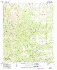
1963 Map of Angus
USGS Topo · Published 1988About this map
Loma Grande Ranch and the small settlement of Angus anchor this high-altitude landscape in the mid-1960s, where the eastern slopes of the Sierra Blanca meet the high mesas of Lincoln County. The map details a transition from the preserved backcountry of the White Mountain Wilderness and Lincoln National Forest to the growing residential areas around Sun Valley, Sierra Vista, and Alto. Infrastructure for water and recreation is prominent, featuring the Phillips Flume and Bonito Lake alongside the Monjeau Lookout and the Villa Madonna compound.
Find a feature on this map
75 named features on this map. Tap any name to fly to it.
Don’t see what you’re looking for? This feature index may not catch every label — zoom into the map to look around manually.
Map Details
Editions of this 1963 Angus Map
4 editions found

Other maps of this area

1934 · Capitan
USGS Topo · 1:48,000

1937 · Capitan
USGS Topo · 1:62,500

1938 · Carrizozo
USGS Topo · 1:48,000

1943 · Carrizozo
USGS Topo · 1:62,500

1950 · Carrizozo
USGS Topo · 1:62,500

1950 · Sierra Blanca Peak
USGS Topo · 1:62,500

1955 · Roswell
USGS Topo · 1:250,000

1958 · Roswell
USGS Topo · 1:250,000

1962 · Roswell
USGS Topo · 1:250,000

1963 · Fort Stanton
USGS Topo · 1:24,000