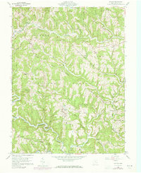
1960 Map of Antioch
USGS Topo · Published 1973About this map
The winding Little Muskingum River carves a deep path through this portion of Monroe County, defining a landscape of narrow ridges and hollows within the Wayne National Forest. The small settlement of Antioch serves as a central point, situated near Lake Glen and the headwaters of Wildcat Run. This 1960 survey, updated in 1973, reveals a dispersed pattern of rural life where family-named ridges like Griffith Ridge and Dent Ridge are dotted with small cemeteries and country churches. Local history is anchored by landmarks such as the Covered Bridge near Mechanicsburg and Fletchers Chapel. The intricate network of "runs" and "hollows," including Grant Hollow and Wolfpen Run, illustrates the rugged drainage patterns that influenced the placement of early homesteads and roads in Adams, Perry, and Jackson townships.
Find a feature on this map
53 named features on this map. Tap any name to fly to it.
Don’t see what you’re looking for? This feature index may not catch every label — zoom into the map to look around manually.
Map Details
Editions of this 1960 Antioch Map
4 editions found
Other maps of this area

1905 · Clarington
USGS Topo · 1:62,500

1905 · New Matamoras
USGS Topo · 1:62,500

1905 · Woodsfield
USGS Topo · 1:62,500

1906 · New Martinsville
USGS Topo · 1:62,500

1924 · New Martinsville
USGS Topo · 1:62,500

1924 · New Matamoras
USGS Topo · 1:62,500

1926 · New Martinsville
USGS Topo · 1:62,500

1926 · New Matamoras
USGS Topo · 1:62,500

1935 · Clarington
USGS Topo · 1:62,500

1940 · Clarington
USGS Topo · 1:62,500