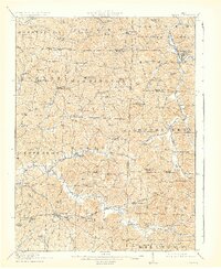
1911 Map of Antrim
USGS Topo · Published 1931About this map
The National Road and Steubenville Road anchor this early 20th-century landscape in Guernsey and Harrison counties, showing a rural society structured around its township lines and local institutions. Small trade centers like Antrim, Londonderry, and Middlebourne are linked by a dense network of country schools, including the notably named Deep Cut School, Moccasin School, and Sligo School. This era reflects a high density of rural education, where schools were placed within walking distance of the many family farms that populated the hills.
Find a feature on this map
91 named features on this map. Tap any name to fly to it.
Don’t see what you’re looking for? This feature index may not catch every label — zoom into the map to look around manually.
Map Details
Editions of this 1911 Antrim Map
3 editions found
Other maps of this area

1902 · Scio
USGS Topo · 1:62,500

1903 · Flushing
USGS Topo · 1:62,500

1904 · Scio
USGS Topo · 1:62,500

1905 · Woodsfield
USGS Topo · 1:62,500

1905 · Flushing
USGS Topo · 1:62,500

1909 · Antrim
USGS Topo · 1:48,000

1909 · Uhrichsville
USGS Topo · 1:62,500

1909 · Summerfield
USGS Topo · 1:62,500

1909 · Cambridge
USGS Topo · 1:62,500

1911 · Antrim
USGS Topo · 1:62,500