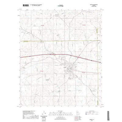
2020 Map of Arcadia
USGS Topo · Published 2020About this map
The Bienville Parish Courthouse serves as the central hub of Arcadia, a town defined by its traditional grid and its intersection with major northern Louisiana transit routes. This modern survey illustrates the persistent importance of regional infrastructure, from the Arcadia-Bienville Parish Airport south of town to the density of country cemeteries that anchor the surrounding rural landscape. To the north, the small settlement of Hurricane is surrounded by a network of drainage systems including Threemile Cr and Black Lake Cr. Genealogists and local historians will find significant value in the sheer number of documented burial sites, such as Old Mount Calm Cem, New Hebron Church Cem, and Macedonia Cem, which mark the history of family landholdings across the parish lines into Claiborne and Lincoln.
Find a feature on this map
116 named features on this map. Tap any name to fly to it.
Don’t see what you’re looking for? This feature index may not catch every label — zoom into the map to look around manually.
Map Details
Editions of this 2020 Arcadia Map
This is the sole edition of this map. No revisions or reprints were ever made.
Other maps of this area

1947 · Bienville
USGS Topo · 1:62,500

1948 · Jamestown
USGS Topo · 1:62,500

1949 · Jamestown
USGS Topo · 1:62,500

1949 · Bienville
USGS Topo · 1:62,500

1949 · Gibsland
USGS Topo · 1:62,500

1950 · Gibsland
USGS Topo · 1:62,500

1950 · Arcadia
USGS Topo · 1:62,500

1951 · Arcadia
USGS Topo · 1:62,500

1955 · Shreveport
USGS Topo · 1:250,000

1956 · Shreveport
USGS Topo · 1:250,000