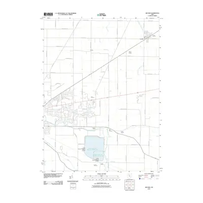
2010 Map of Arcadia
USGS Topo · Published 2010About this map
Arcadia serves as the primary settlement on this sheet, situated at the junction of several rural routes including County Rd 254 and County Rd 216. The landscape is defined by the heavy management of water, most notably the massive Findlay Upground Reservoir Number One and Findlay Upground Reservoir Number Two, which dominate the southern portion of the map. These large-scale engineered basins are fed and drained by local waterways such as the Blanchard River and Lye Creek.
Find a feature on this map
60 named features on this map. Tap any name to fly to it.
Don’t see what you’re looking for? This feature index may not catch every label — zoom into the map to look around manually.
Map Details
Editions of this 2010 Arcadia Map
This is the sole edition of this map. No revisions or reprints were ever made.
Other maps of this area

1901 · Fostoria
USGS Topo · 1:62,500

1903 · Fostoria
USGS Topo · 1:62,500

1903 · Findlay
USGS Topo · 1:62,500

1905 · Arlington
USGS Topo · 1:62,500

1907 · Arlington
USGS Topo · 1:24,000

1907 · Upper Sandusky
USGS Topo · 1:62,500

1950 · Marion
USGS Topo · 1:250,000

1956 · Toledo
USGS Topo · 1:250,000

1960 · Bloomdale
USGS Topo · 1:24,000

1960 · Alvada
USGS Topo · 1:24,000