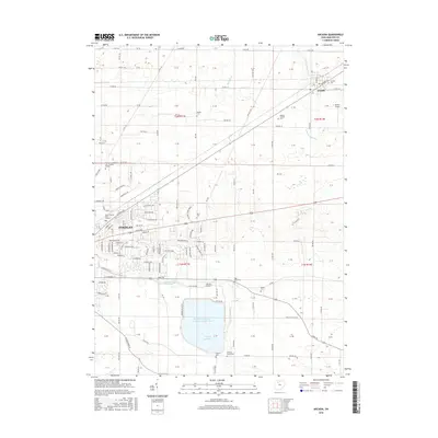
2016 Map of Arcadia
USGS Topo · Published 2016About this map
The agricultural landscape of eastern Hancock County is punctuated by the significant water management systems south of the Blanchard River, most notably the massive Findlay Reservoir and its companion, Findlay Upground Reservoir Number Two. These large-scale engineered basins sit amidst a grid of rural township roads and historic family burial grounds like Hamlin Cem and Alspach Cem. To the east, the village of Arcadia serves as a local hub near the S Br Portage River, while the eastern fringes of Findlay show the reach of regional institutions including the Owens Community Coll - Findlay Campus and Brown Mackie Coll - Findlay. This era of the landscape is defined by this blend of traditional small-town settlement, intensive grain farming, and modern infrastructure, including aviation facilities like Rutter Airport and Weaver Airport.
Find a feature on this map
155 named features on this map. Tap any name to fly to it.
Don’t see what you’re looking for? This feature index may not catch every label — zoom into the map to look around manually.
Map Details
Editions of this 2016 Arcadia Map
This is the sole edition of this map. No revisions or reprints were ever made.
Other maps of this area

1901 · Fostoria
USGS Topo · 1:62,500

1903 · Fostoria
USGS Topo · 1:62,500

1903 · Findlay
USGS Topo · 1:62,500

1905 · Arlington
USGS Topo · 1:62,500

1907 · Arlington
USGS Topo · 1:24,000

1907 · Upper Sandusky
USGS Topo · 1:62,500

1950 · Marion
USGS Topo · 1:250,000

1956 · Toledo
USGS Topo · 1:250,000

1960 · Bloomdale
USGS Topo · 1:24,000

1960 · Alvada
USGS Topo · 1:24,000