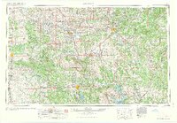
1963 Map of Ardmore
USGS Topo · Published 1963About this map
Lake Texoma and the Arbuckle Mountains dominate this mid-century portrait of southern Oklahoma, showing a landscape defined by its river systems and early federal investments. Major rail corridors like the Atchison Topeka and Santa Fe and the Chicago Rock Island and Pacific cross the region, connecting hubs like Ardmore, Ada, and Duncan. The map documents a significant era of land management and defense, featuring the Ardmore Air Force Base, the Naval Ammunition Depot, and the Tishomingo National Wildlife Refuge.
Find a feature on this map
116 named features on this map. Tap any name to fly to it.
Don’t see what you’re looking for? This feature index may not catch every label — zoom into the map to look around manually.
Map Details
Editions of this 1963 Ardmore Map
2 editions found

Other maps of this area

1893 · Norman
USGS Topo · 1:62,500

1896 · Seminole and Prague
USGS Topo · 1:125,000

1896 · Coalgate
USGS Topo · 1:125,000

1898 · Purcell
USGS Topo · 1:125,000

1898 · McAlester
USGS Topo · 1:125,000

1898 · Pauls Valley
USGS Topo · 1:125,000

1899 · Coalgate
USGS Topo · 1:125,000

1899 · Atoka
USGS Topo · 1:125,000

1900 · Canadian
USGS Topo · 1:125,000

1900 · Wewoka
USGS Topo · 1:125,000