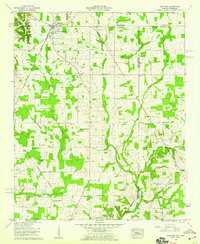
1958 Map of Ardmore
USGS Topo · Published 1959About this map
Ardmore straddles the state line where Alabama and Tennessee meet, serving as a focal point for the surrounding agricultural communities in the late 1950s. The Louisville and Nashville railroad cuts through the center of town, anchoring a landscape dotted with numerous rural congregations and family burial grounds. Notable landmarks include the Wooley Springs Sch, Mays Chapel, and the Delap-Clement Cem.
Find a feature on this map
69 named features on this map. Tap any name to fly to it.
Don’t see what you’re looking for? This feature index may not catch every label — zoom into the map to look around manually.
Map Details
Editions of this 1958 Ardmore Map
4 editions found
Other maps of this area

1888 · Huntsville
USGS Topo · 1:125,000

1892 · Huntsville
USGS Topo · 1:125,000

1935 · Athens
USGS Topo · 1:24,000

1936 · Jeff
USGS Topo · 1:24,000

1936 · Capshaw
USGS Topo · 1:24,000

1936 · Taft
USGS Topo · 1:24,000

1936 · Elkmont
USGS Topo · 1:24,000

1936 · Ardmore
USGS Topo · 1:24,000

1936 · Toney
USGS Topo · 1:24,000

1936 · Elkton
USGS Topo · 1:24,000