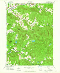
1945 Map of Arena
USGS Topo · Published 1965About this map
The East Branch Delaware River winds through the northern portion of this Catskill terrain, marking a landscape defined by steep ridges and narrow stream valleys. The settlement of Arena serves as a primary hub near the river, while smaller mountain hamlets like Grant Mills and Turnwood are tucked away along the Mill Brook and Beaver Kill drainage systems. This 1945 field check preserves the location of rural infrastructure before mid-century changes, including the Old Stone Sch and School No 8.
Find a feature on this map
39 named features on this map. Tap any name to fly to it.
Don’t see what you’re looking for? This feature index may not catch every label — zoom into the map to look around manually.
Map Details
Editions of this 1945 Arena Map
4 editions found
Other maps of this area

1901 · Margaretville
USGS Topo · 1:62,500

1904 · Margaretville
USGS Topo · 1:62,500

1910 · Neversink
USGS Topo · 1:62,500

1921 · Livingston Manor
USGS Topo · 1:62,500

1922 · Andes
USGS Topo · 1:62,500

1923 · Livingston Manor
USGS Topo · 1:62,500

1924 · Andes
USGS Topo · 1:62,500

1942 · Neversink
USGS Topo · 1:62,500

1943 · Monticello
USGS Topo · 1:125,000

1944 · Livingston Manor
USGS Topo · 1:62,500