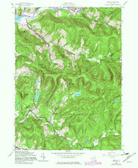
1945 Map of Arena
USGS Topo · Published 1983About this map
Arena and the high peaks of the Catskill Park define this landscape during the mid-1940s, a period when the topography of the region was being reshaped by large-scale water projects. The northwestern corner is dominated by the Pepacton Reservoir, which inundated former valley communities along the East Branch Delaware River. Traces of the older infrastructure remain visible, such as the Old Railroad Grade winding through the valley near the Gaging Station. Moving south into the Hardenbergh region, the map reveals a more isolated pattern of high-altitude settlement. Small hamlets like Turnwood and Grant Mills are connected by narrow roads following the Beaver Kill and Mill Brook. The presence of School No 8 and numerous small lakes like Alder Lake and Beecher Lake suggests a community structure built around mountain agriculture and early recreational retreats within the vast Forest Preserve.
Find a feature on this map
34 named features on this map. Tap any name to fly to it.
Don’t see what you’re looking for? This feature index may not catch every label — zoom into the map to look around manually.
Map Details
Editions of this 1945 Arena Map
4 editions found
Other maps of this area

1901 · Margaretville
USGS Topo · 1:62,500

1904 · Margaretville
USGS Topo · 1:62,500

1910 · Neversink
USGS Topo · 1:62,500

1921 · Livingston Manor
USGS Topo · 1:62,500

1922 · Andes
USGS Topo · 1:62,500

1923 · Livingston Manor
USGS Topo · 1:62,500

1924 · Andes
USGS Topo · 1:62,500

1942 · Neversink
USGS Topo · 1:62,500

1943 · Monticello
USGS Topo · 1:125,000

1944 · Livingston Manor
USGS Topo · 1:62,500