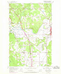
1956 Map of Arlington West
USGS Topo · Published 1969About this map
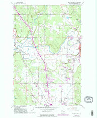
The Stillaguamish River and its complex network of sloughs, including Cook Slough and South Slough, define this Snohomish County landscape as it appeared in the mid-1950s with late-1960s updates. The topography is dominated by The Island, a large landmass carved by the river's path, while the Northern Pacific railroad corridor serves as the primary industrial spine for the region. To the south, the expansion of Arlington Airport and the emerging hub at Smokey Point indicate the area's transition toward post-war aviation and commerce.
Find a feature on this map
58 named features on this map. Tap any name to fly to it.
Don’t see what you’re looking for? This feature index may not catch every label — zoom into the map to look around manually.
Map Details
Editions of this 1956 Arlington West Map
6 editions found
Other maps of this area

1911 · Mount Vernon
USGS Topo · 1:125,000

1940 · Mt Vernon
USGS Topo · 1:62,500

1941 · Marysville
USGS Topo · 1:62,500

1943 · Marysville
USGS Topo · 1:62,500

1943 · Mt Vernon
USGS Topo · 1:62,500

1943 · Stanwood
USGS Topo · 1:62,500

1944 · Clear Lake
USGS Topo · 1:62,500

1956 · Tulalip
USGS Topo · 1:24,000

1956 · Arlington West
USGS Topo · 1:24,000

1956 · Arlington East
USGS Topo · 1:24,000