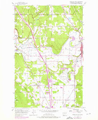
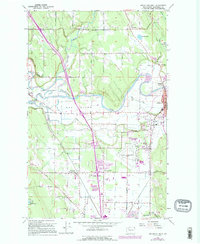
1956 Map of Arlington West
USGS Topo · Published 1976About this map
The Stillaguamish River defines the heart of this Snohomish County landscape, winding past The Island and through a network of sloughs near Silvana. This 1950s survey, updated with mid-1970s land-use data, captures a significant era of transition as the industrial and transport infrastructure of the Puget Sound region expanded. The presence of the Arlington Airport and the sprawling rail corridor of the Burlington Northern underscore the area's importance as a logistics hub.
Find a feature on this map
56 named features on this map. Tap any name to fly to it.
Don’t see what you’re looking for? This feature index may not catch every label — zoom into the map to look around manually.
Map Details
Editions of this 1956 Arlington West Map
6 editions found
Other maps of this area

1911 · Mount Vernon
USGS Topo · 1:125,000

1940 · Mt Vernon
USGS Topo · 1:62,500

1941 · Marysville
USGS Topo · 1:62,500

1943 · Marysville
USGS Topo · 1:62,500

1943 · Mt Vernon
USGS Topo · 1:62,500

1943 · Stanwood
USGS Topo · 1:62,500

1944 · Clear Lake
USGS Topo · 1:62,500

1956 · Tulalip
USGS Topo · 1:24,000

1956 · Arlington West
USGS Topo · 1:24,000

1956 · Arlington East
USGS Topo · 1:24,000