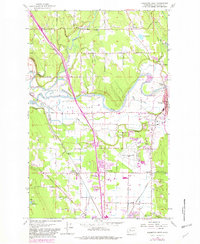
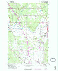
1956 Map of Arlington West
USGS Topo · Published 1982About this map
The Stillaguamish River and its intricate distributaries, including Cook Slough and S Slough, dominate this mid-century landscape in Snohomish County. The terrain is characterized by the broad, low-lying alluvial plain known as The Island, bounded by the river and the surrounding marshy sloughs. Industrial and transit hubs are concentrated to the east, where the Burlington Northern railroad lines intersect at Arlington Junction and serve the burgeoning community of Arlington.
Find a feature on this map
58 named features on this map. Tap any name to fly to it.
Don’t see what you’re looking for? This feature index may not catch every label — zoom into the map to look around manually.
Map Details
Editions of this 1956 Arlington West Map
6 editions found
Other maps of this area

1911 · Mount Vernon
USGS Topo · 1:125,000

1940 · Mt Vernon
USGS Topo · 1:62,500

1941 · Marysville
USGS Topo · 1:62,500

1943 · Marysville
USGS Topo · 1:62,500

1943 · Mt Vernon
USGS Topo · 1:62,500

1943 · Stanwood
USGS Topo · 1:62,500

1944 · Clear Lake
USGS Topo · 1:62,500

1956 · Tulalip
USGS Topo · 1:24,000

1956 · Arlington West
USGS Topo · 1:24,000

1956 · Arlington East
USGS Topo · 1:24,000