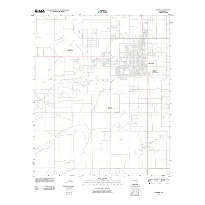
2010 Map of Artesia
USGS Topo · Published 2010About this map
The city of Artesia serves as the focal point of this Eddy County landscape, where the grid of city streets transitions into the expansive ranchlands of the Pecos Valley. A notable historic landmark on the northern edge of town is the Prisoner of War Camp, a reminder of the region's mid-century military history. The map captures the infrastructure supporting the local economy, including the Artesia Municipal Airport and the smaller 2 X 4 Ranch Airport to the southeast. Natural drainage patterns are defined by Eagle Creek and Tumbleweed Draw, which cross the arid terrain toward the SE Storm Drainage Detention Dam. Rural life is marked by the presence of the Eddy County Fairgrounds and outlying settlements like Atoka, alongside established family operations such as McKinstry Ranch.
Find a feature on this map
49 named features on this map. Tap any name to fly to it.
Don’t see what you’re looking for? This feature index may not catch every label — zoom into the map to look around manually.
Map Details
Editions of this 2010 Artesia Map
This is the sole edition of this map. No revisions or reprints were ever made.
Other maps of this area

1953 · Espuela
USGS Topo · 1:24,000

1954 · Carlsbad
USGS Topo · 1:250,000

1955 · Artesia
USGS Topo · 1:24,000

1955 · Artesia NE
USGS Topo · 1:24,000

1955 · Spring Lake
USGS Topo · 1:24,000

1955 · Dayton
USGS Topo · 1:24,000

1955 · Lake Mc Millan North
USGS Topo · 1:24,000

1955 · Hope NE
USGS Topo · 1:24,000

1956 · Parish Ranch
USGS Topo · 1:24,000

1956 · Hope SE
USGS Topo · 1:24,000