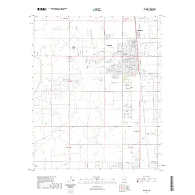
2023 Map of Artesia
USGS Topo · Published 2023About this map
Artesia serves as the central hub of this 2023 survey, revealing the modern street grid and layout of this Eddy County community. The map details residential expansion through neighborhoods like Morningside to the north and the nearby settlement of Atoka to the south. Genealogists can identify significant burial sites including Woodbine Cem and Turknett Cem, which are preserved amidst the developing suburban landscape. The topography is defined by the ephemeral passage of Eagle Creek and the southern Tumbleweed Draw, illustrating how water drainage patterns influence the regional road network. Infrastructure such as the Artesia Municipal Airport and a dense network of county roads, including Co Rd 110 and Co Rd 59, highlight the area's role as a transportation and service center in southeastern New Mexico.
Find a feature on this map
128 named features on this map. Tap any name to fly to it.
Don’t see what you’re looking for? This feature index may not catch every label — zoom into the map to look around manually.
Map Details
Editions of this 2023 Artesia Map
This is the sole edition of this map. No revisions or reprints were ever made.
Other maps of this area

1953 · Espuela
USGS Topo · 1:24,000

1954 · Carlsbad
USGS Topo · 1:250,000

1955 · Artesia
USGS Topo · 1:24,000

1955 · Artesia NE
USGS Topo · 1:24,000

1955 · Spring Lake
USGS Topo · 1:24,000

1955 · Dayton
USGS Topo · 1:24,000

1955 · Lake Mc Millan North
USGS Topo · 1:24,000

1955 · Hope NE
USGS Topo · 1:24,000

1956 · Parish Ranch
USGS Topo · 1:24,000

1956 · Hope SE
USGS Topo · 1:24,000